|
|
Post by PeterB on Oct 18, 2006 20:40:47 GMT -4
G'day folks
I know I mentioned this some time before, but I don’t remember whether it was on this version of the board or an earlier one, so I thought I’d start from scratch…
My wife’s wedding present to me has been to commission a painting from a local artist who makes a living from painting landscapes and militaria (especially ships and aircraft). I’ve spoken to the artist and shown him some photos I printed from the Apolloarchive site, and we both have a rough idea of what I have in mind, but I need to get some more detailed images to him so he can proceed.
The idea I have for the picture is a Saturn V rocket, just after casting off the first stage, the interstage and the Boost Protective Cover/Launch Escape Tower. The angle would be such that the rocket would form a rising diagonal, slightly angling out of the picture towards the viewer, with the Earth in the background. I realise that the BPC and LET were discarded about 30 seconds after the first stage, but I wanted to compress events to include them in the one image.
Now the idea of what the picture should look like is one thing. Actually creating the image is another. I've given the artist a picture of the Saturn stack looking down from above, and some images of the Command and Service module. But he doesn’t know how big the Earth would be, what would be visible on the Earth, where the Sun would be, or exactly what the discarded segments would look like.
So I was wondering if anyone could point me towards sites I could go to which would help with these factors, preferably in a graphic format so I can print them out and show the artist.
Cheers
|
|
|
|
Post by echnaton on Oct 18, 2006 21:31:48 GMT -4
You are lucky man to have such a thoughtful wife.
I don’t know about the accuracy of Google Earth, but it does give an altitude measure for its views. Play around with that until you find something you like. Depending on your desire for a realistic view, from an artistic perspective it might be better to put recognizable features of Florida in the background even if the altitude of the view does not coincide with the rockets actual altitude and the real background from the viewers perspective.
|
|
|
|
Post by Kiwi on Oct 18, 2006 22:01:58 GMT -4
Gidday Peter. Hope you're recovering well from your surgery. Yes, I remember you mentioning the painting. What about the "From the Earth to the Moon" and "Apollo 13" DVDs for ideas? They have interesting graphics of launches similar to what you mention and some have the time frame compressed for the first stage, interstage and LET separation. I liked Ron Howard's comment about this in the documentary "Lost Moon: The Triumph of Apollo 13" that comes on disc 2 of "Apollo 13 ": 0:25:11 Ron Howard: Buzz Aldrin came up to me and said, "In that launch footage I saw some shots I'd never seen before. Did you guys... What vault did you find that stuff in?" And I said, "Well, no vault, Buzz, we generated all that from scratch." And he said, "Oh. That's pretty good. Can we use it?"FTETTM, part 4, 1968, shows Apollo 8's staging at 0:25:05, but has some wonderful blunders later, such as: 0:26:08 Error: Apollo 8 travels between the Indus River and the Gulf of Kutch, almost due south. It did not travel in that direction. and 0:28:21 Error: Apollo 8 is heading northwest above the Gulf of California during TLI — opposite to the direction it should be heading, and not near this part of the planet. TLI started in darkness over the Pacific.Edited to add: Here's your original thread |
|
|
|
Post by Jason Thompson on Oct 19, 2006 4:43:28 GMT -4
With regard to what each segment should look like, try this website: apollomaniacs.web.infoseek.co.jp/apollo/saturne.htmIt's got some lovely images of each stage and section. There's another page on the same site that covers the Apollo spacecraft and the LES/BPC. Also, if you look on Google video, you should be able to find the onboard film from the staging of Apollo 4. This would be useful for getting an idea for what the discarded interstage looks like (and what it does after staging in terms of its motion) as well as the top of the S-IC LOX tank. |
|
Bob B.
Bob the Excel Guru?
Posts: 3,072
|
Post by Bob B. on Oct 19, 2006 10:06:20 GMT -4
That page gives just about every view except one looking down on the top of the first stage, which will probably be needed if S-IC separation will be depicted. The following is an excellent a picture showing exactly what the top of the S-IC looked like ( with the lifting device attached). history.nasa.gov/ap11ann/kippsphotos/69-HC-307.jpgAnd the following is a good photo of an actual Saturn V with the stages separated (interstage adapters not included) ( and lifting device in place). www.geocities.com/launchreport/s5msc1.jpgAs far as what will be visible on the Earth below, here is what I wrote in your original thread back in February: This web page gives some information on the Apollo 11 ascent. (The page has similar information on all the ascents but I picked Apollo 11 as an example.) The time you are talking about is shortly after S-IC/S-II separation. The Web page gives us the following:
Altitude: 36.029 nm
Range: 51.323 nm
Latitude: 28.7046 deg N
Longitude: 79.6764 deg E
Flight Path Angle: 19.020 deg
Heading Angle: 75.436 deg
Latitude and Longitude of course gives you the exact location of the spacecraft. Flight path angle is the angle from horizontal and heading angle is measured east of north. This should give your artist a pretty good idea of the location and orientation of the spacecraft at the time in question. (If you want to advance the clock a bit you can always interpolate from the information given in the table.)
At an altitude of 36.029 nm, the distance to the horizon is about 500 nm (925 km). If you find the given latitude and longitude on a map and draw a circle with a radius equivalant to 500 nm centered on that location, then you should have a good idea of what land features are visible. The edge of the circle is the horizon and everything inside it is visible from the spacecraft. You know the heading of the rocket and the angle at which the artist will depict it, so you should be able to figure out the direction of view and the visible landmarks. Regarding the size of the Earth, the horizon will be about 4-degrees below the local horizontal plane. The Earth will therefore fill about 46.5% of the total sky. EDIT: Modified to include additional clarification provided by Jason Thompson. |
|
|
|
Post by Jason Thompson on Oct 19, 2006 11:43:11 GMT -4
|
|
|
|
Post by Jason Thompson on Oct 19, 2006 11:48:02 GMT -4
The following is an excellent picture showing exactly what the top of the S-IC looked like.
Actually, that's a pretty poor picture. The top of the S-IC and the LOX tank bulkhead is obscured by the lifting attachment.You can see from the film of actual staging that this spidery frame is not present on the flown vehicle.
|
|
Bob B.
Bob the Excel Guru?
Posts: 3,072
|
Post by Bob B. on Oct 19, 2006 14:53:51 GMT -4
The following is an excellent picture showing exactly what the top of the S-IC looked like.
Actually, that's a pretty poor picture. The top of the S-IC and the LOX tank bulkhead is obscured by the lifting attachment.You can see from the film of actual staging that this spidery frame is not present on the flown vehicle. Forget what I said then. I've been unable to locate a photograph showing the forward end of the S-IC without the lifting device. The best I can find is the following diagram: www.thekeyboard.org.uk/Saturn%20V%20diagram.htmHopefully between the diagram, video, and photograph, there is enough imagery here to provide the necessary detail. |
|
reynoldbot
Jupiter
A paper-white mask of evil.
Posts: 790
|
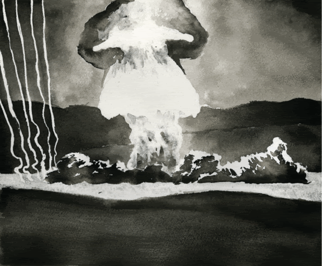
Post by reynoldbot on Oct 20, 2006 4:40:00 GMT -4
I'm finding the temptation to plug my artwork incredibly hard to resist. I've got a watercolor illustration depicting Apollo 15 that I could provide a very high quality print of for relatively (fancy word for dirt) cheap. I've got a low res jpeg copy for you to see if you are interested. I guess you can't blame me for trying.
|
|